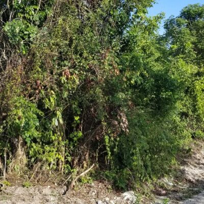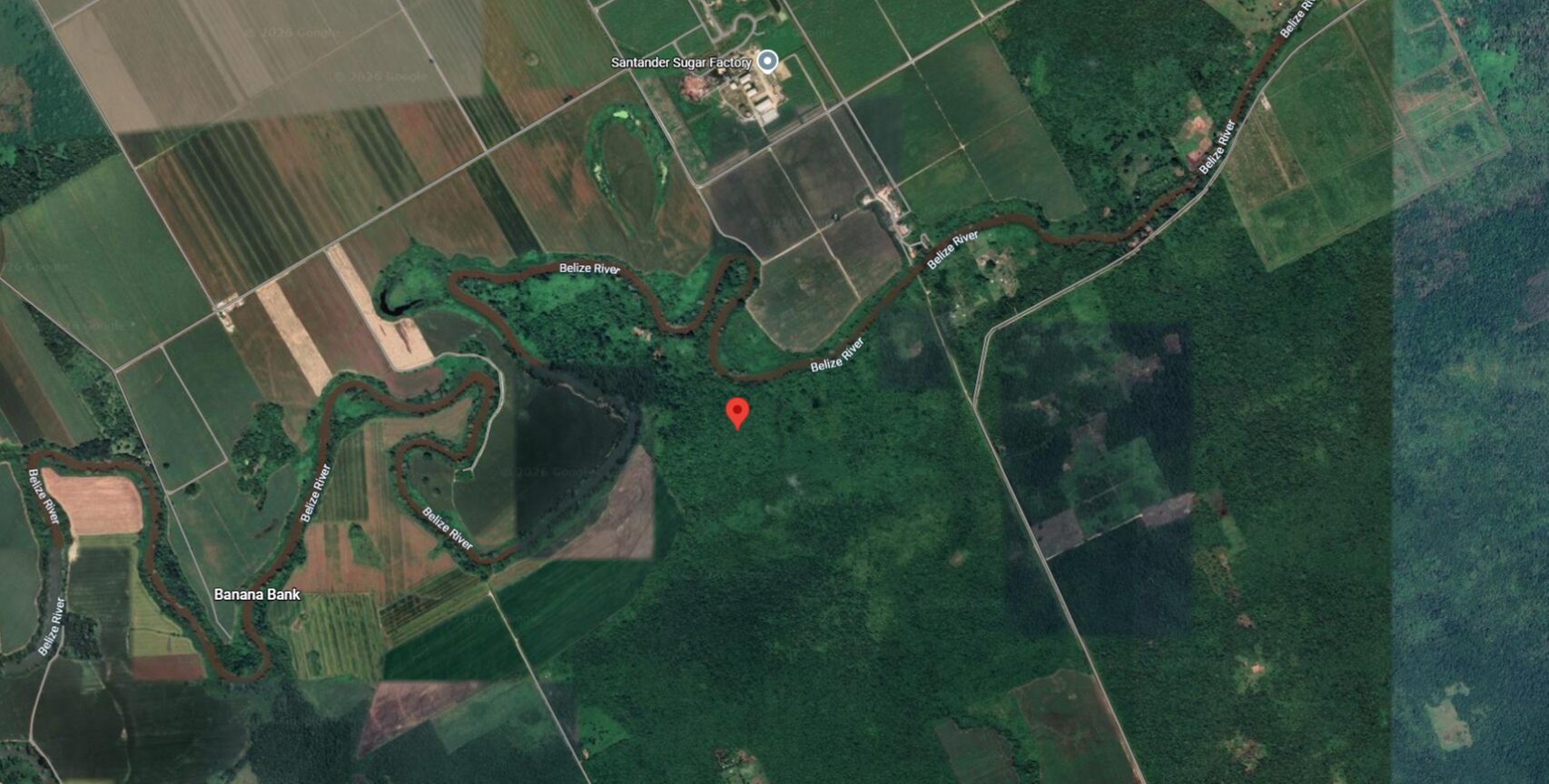


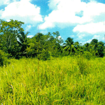
Parcel No. 901, Block No. 20 Mount Pleasant, Cayo District
Location: Mount Pleasant area, Cayo District. The Property is bounded on the north by Belize River.
Description: Parcel No. 901, Block No. 20 All that parcel of land containing 25.036 acres (101,316.30 sq.m), Titled Acreage, River Frontage.
$310,000.00
1 in stock
The Vendor
- Vendor: ArnoldAuctions
- Address:
- No ratings found yet!
-
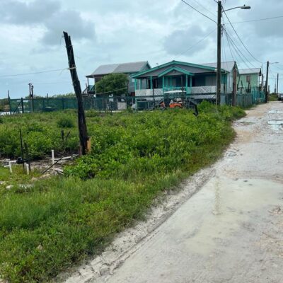
Parcel No. 2949, Block No. 7, San Pedro Town – LICU
Auction EndedParcel No. 2949, Block No. 7, San Pedro Registration Section containing 445.685 Square Meters situate in San Pedro Town, Ambergris Caye, Belize District held under a Land Certificate and being the freehold interest of LEON LEVI ANDERSON.
This empty lot is found near a man made canal and said piece or parcel of land is fairly well elevated but currently undeveloped. It is located within access of utilities including electricity and telephone.
-
Parcel No. 414, Block 1, Caledonia/ Buena Vista, Corozal District – LICU
Auction EndedProperty Details: ALL THAT piece or parcel of land being Parcel No. 414, Block 1, situated in the Caledonia/Buena Vista Registration Section, Corozal District containing 982.767 S.M. and held under a Land Certificate and being thereon, the freehold property of Hipolita Garcia surety for Filomena Ewan.
Description: This parcel of land is an empty lot and is located two blocks away from the Northern Highway and is immediately along the Caledonia Road.
-
Lot 125, Independence Village, Stann Creek District – ASC.
Auction EndedLocation: Lot #125, situated in Independence Village, Stann Creek District.
Description: On the property is a two storey building having 2 bedrooms, one bathroom apartment on the lower level, while the upper level has a 3 bedroom, 1 bathroom apartment. The property is held in the Freehold Interest.
-
Parcel No.1021, Block 1, San Estevan, Orange Walk District – LICU
Auction EndedProperty Details: ALL THAT piece or parcel of land being Parcel No. 1021, Block 1, situated in the San Estevan Registration Section, Orange Walk District containing 810.109 S.M and held under Land Certificate and being thereon, the freehold property of Antonia Cruz Sanchez surety for Alfonso Manuelito Padron.
Description: This parcel of land is an empty lot and is located in a recent expansion of the San Estevan Village.
-
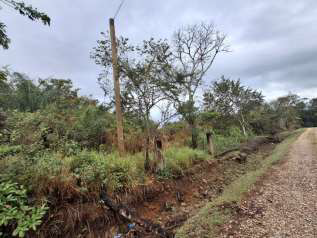
Parcel No. 3217, Block No. 4, Ann Gabourel, situated in Black Water Creek Area, Trial Farm Village, Orange Walk District. LICU
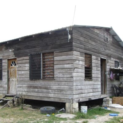
Auction EndedParcel No. 3217, Block No. 4, Ann Gabourel Registration Section containing 696.697 Square Meters situate in Black Water Creek Area, Trial Farm Village, Orange Walk District held under a Land Certificate and being the freehold interest of NERY LEONARDO SOSA & JOSSELIN JANNETHE ALVARADO surety for NERY LEONARDO SOSA.
One slightly elevated (2) two bedroom wooden structure containing 1 kitchen, dining, living & bath. The property is located in walking distance from the Trial Farm Village burial site and in close proximity of the San Lorenzo Housing Site, Orange Walk Town.
-
2019 BUICK ENVISION FOR SALE
$29,000.00VEHICLE SPECS:
ASKING PRICE: $29,000.00BZ
- Mileage; 118K Miles
- 4 Doors
- Capacity 5
- Full Tank Capacity 17.3 Gallons
- Leather Seats
- Alarm System
- Air Conditioning
- Power Windows/Doors/Seats/Locks
- Push Start/Auto Stop
- Reverse Camera
- Child Safety Locks
- Fog Lights
- Anti Lock Brakes
- Reverse Camera
- Steering Wheel Audio Control


Related products
-
Parcel No. 2837, Block No. 23, San Ignacio South, San Ignacio Town, Cayo District – LICU
Auction EndedParcel No. 2837, Block No. 23, San Ignacio South Registration Section containing 491.53 Square Meters situate in the San Ignacio South Registration Section Area, San Ignacio Town, Cayo District held under a Land Certificate and being the freehold interest of ALBERTO ISIAS BOBADILLA.
Found in the outskirts of San Ignacio Town, Cayo District, this empty plot of land is located in a developing area.
-
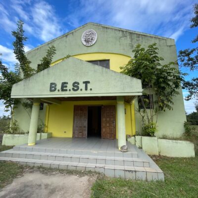
Parcel 3115, Block 20, City of Belmopan, Cayo District
Auction Ended- Prime Commercial Lot 3,036.174 sq. m. (0.75 acres)
- Strategically Located, Adaptable Commercial Space, Prime Road Connectivity
BUILDING #1
- Two-storey Office Building – 3,582 sq. ft.
- 6 Office spaces
- 4 Bathrooms
- 2 Storage areas
- 1 Conference room
- 1 Reception area
- 1 Kitchen
BUILDING #2
- Storage – 823 sq.ft.
- 1 Office
- 1 Bathroom
- 1 Open space